
Water typing is the state-sanctioned process of mapping the distribution of fish and fish habitat. Regulatory water type maps are used to regulate land use decisions adjacent to streams, ponds, and wetlands. Because existing (modeled) regulatory maps often significantly misrepresent the presence, location, and extent of fish habitat, the effectiveness of state and local government fish habitat protection regulations is compromised.
Thurston County has been one of the fasted growing counties in the state during the past decade, adding an average 35,900 residents each year. Thurston Regional Planning Council predicts that by 2025, the county’s population will increase by 58%. In the face of these development pressures, it is increasingly important to ensure that growth occurs responsibly and not at the expense of salmon and the ecosystems they rely upon. Because Cooper and Johnson Points, and the Steamboat Island peninsula are located within and just outside of the City of Olympia their environments are highly susceptible to near-future development.
WDFW has identified one of the primary sources of habitat loss in the South Puget Sound basin as residential development and road building. “These activities result in loss of riparian vegetation, increased sediment loads, high run-off rates, and blockages to migration…” (WA State Salmonid Stock Inventory – Coastal Cutthroat Trout. 2000).
All cities and counties in Washington are required to adopt critical areas regulations by the Growth Management Act (RCW 36.70A.060). The GMA was amended in 1995 to require counties and cities to include the best available science in developing policies and development regulations to protect the functions and values of critical areas (RCW 36.70A.172). All jurisdictions are required to review, evaluate, and, if necessary, revise their critical areas ordinances to ensure that they meet GMA requirements.
The amount of protection that streams receive in Thurston County and in the City of Olympia is regulated by the water type classification system developed by the Washington Department of Natural Resources (WDNR) (Thurston County Code Chapter 17.15; Olympia Municipal Code 18.32.410). Type 1, 2, and 3 streams are considered fish-bearing, and receive greater protection (in the form of buffers) than Type 4 and 5 (non fish-bearing) streams. For a detailed discussion of how water type classification relates to stream buffer width requirements, see Thurston County Code 17.15.935 and Olympia Municipal Code 18.32.435.
The ability of this classification system to protect fish and their habitats is directly related to the accuracy of the water type classifications assigned to the streams in the County. Alarmingly, numerous studies performed by Wild Fish Conservancy have documented large (>50%) error rates associated with WDNR water type classifications in western Washington (http://www.washingtontrout.org/maps.shtml); consequently, thousands of miles of unmapped and misclassified streams do not receive the protection they warrant.
Errors in water type maps typically fall into two main categories:
Wild Fish Conservancy Watertype Assessment Project objectives are fivefold:
In addition to ensuring that the best available science is used to identify and protect fish habitats under existing laws, this assessment will fill data gaps regarding fish passage impediments (diversion dams, withdrawal systems, etc.) and fish species composition and distribution – information needed to responsibly identify, prioritize, and implement effective and science-based restoration projects in WRIA 13. This assessment will also lead to the direct identification of restoration and protection opportunities within the study watersheds.
Project Caveats
The following caveats apply to the Wild Fish Conservancy Watertype Assessment Project:
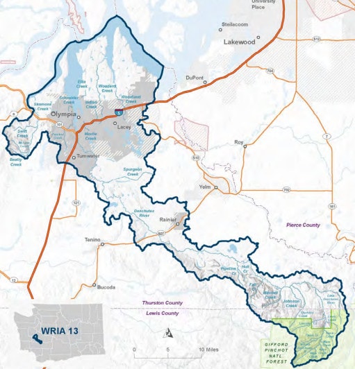
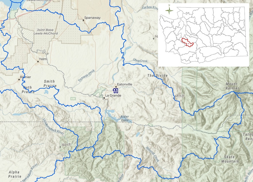
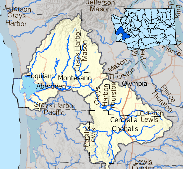
During the spring months of 2005, 2006, and 2007, Wild Fish Conservancy crews performed watertype assessments on 167 streams that flow directly into South Puget Sound near Olympia. Surveys were conducted along streams at public road right-of-ways as well as private parcels of land where permission was granted.
The survey covered approximately 61,000 acres, encompassing 162 miles of stream channel. Over 1700 photographs (with associated channel condition descriptions) are presented on the interactive map. Fish species encountered during the surveys included cutthroat trout, rainbow trout, coho salmon, chinook salmon, sculpin, stickleback, Olympic mudminnow, and brook lamprey.
As expected based on previous Wild Fish Conservancy watertype assessments, significant discrepancies existed between the Washington Department of Natural Resources (WDNR) regulatory maps and what we found on the ground. For example, on Cooper Point WDNR had identified 16.2 miles of streams. Following our surveys, WFC mapped 28.1 miles of stream.
Summary statistics for the entire survey (to date, covering 160 miles of streams on 61,000 acres on north Thurston County) show that WDNR had identified 134.6 miles of streams while WFC mapped 161.6 miles of stream. Note that when WFC did not have permission to access a stream reach and could not verify water type from upstream, that stream reach was listed as Type U (Type 9, or Unknown) regardless of how WDNR had classified that reach.
Funding for this project was provided by the Salmon Recovery Funding Board. Wild Fish Conservancy would also like to acknowledge the support and assistance provided to this project by through WRIA 13 Lead Entity process, including but not limited to representatives from WDFW, the Squaxin Island Tribe, Thurston County, Thurston Regional Planning Council, City of Olympia, City of Tumwater, South Puget Sound Salmon Enhancement Group, Thurston Conservation District, Capital Land Trust, and People for Puget Sound.
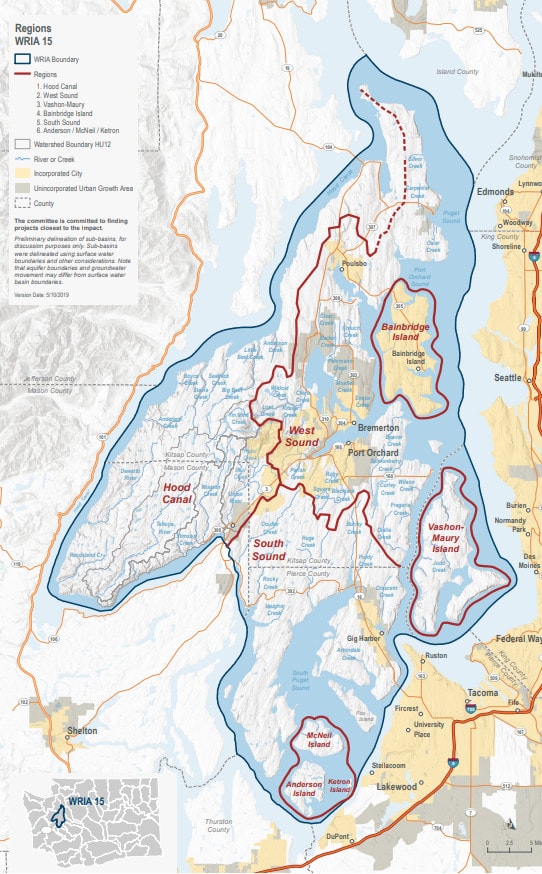
During the 2010-2011 water type field seasons, Wild Fish Conservancy crews performed water type assessments on 24 streams that flow directly into West Sound between Suquamish and Indianola, WA. Surveys document the distribution of fish and fish habitat in West Puget Sound streams in Kitsap and Pierce counties, WA.
This water type assessment encompassed 61 miles of streams draining into and adjacent to Miller Bay in N. Kitsap County.
During the 2011-2013 water type field seasons, Wild Fish Conservancy crews performed
water type assessments on 40 streams that flow directly into Puget Sound at the north end of
the Kitsap Peninsula between Indianola, WA and Port Gamble, WA. Also included were
Blackjack Creek near Port Orchard and portions of lower Chico Creek near Bremerton, WA.
The survey encompassed 128 miles of streams.
During the 2014-2016 water type field seasons, Wild Fish Conservancy crews performed
water type assessments on 72 streams that flow directly into Puget Sound on Bainbridge
Island and Key Peninsula, adding to previous (Phase I and II) West Sound water typing efforts.
The survey encompassed 275 miles of streams.
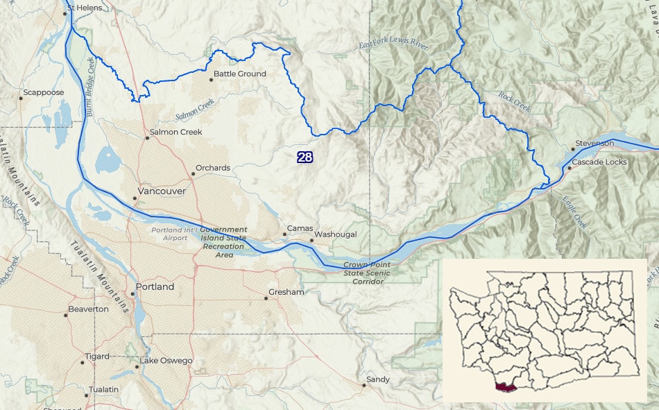
Surveys of Salmon Creek and tributaries in Clark County near Vancouver, WA. WFC performed this project in partnership with the Salmon Creek Watershed Council.
Survey of Patterson creek and tributaries in King County, WA. This project was funded by the SRFB and King Conservation District.
Surveys of Pilchuck Creek and tributaries in Snohomish County, WA. This project was funded by the Salmon Recovery Funding Board and King Conservation District.
Surveys of Pilchuck Creek and tributaries in Snohomish County, WA. This project was funded by the Salmon Recovery Funding Board and King Conservation District.
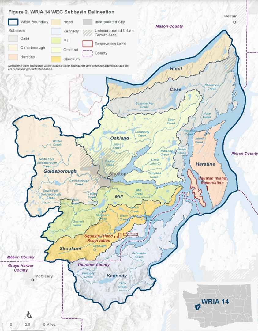
Surveys of streams flowing into Puget Sound on Arcadia and Kamilche points in Mason County, Washington to document the distribution of fish and fish habitat.
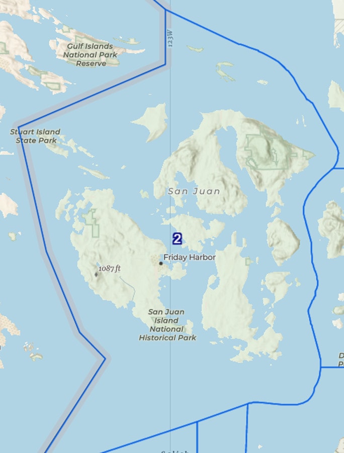
Surveys of streams on San Juan and Orcas Island, Washington to document the distribution of fish and fish habitat.
Surveys of 18 watersheds within the City of Redmond, Washington to document the distribution of fish and fish habitat.
Surveys of two watersheds in Island County (Whidbey and Camano Islands in Puget Sound), Washington to document, inventory, and evaluate fish distribution, species composition, and instream habitat.
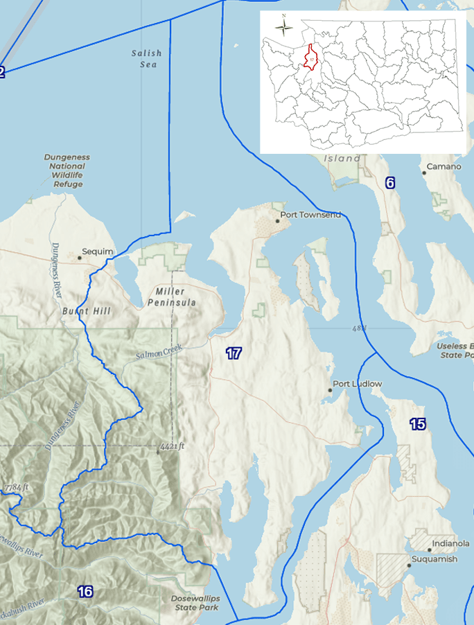
Surveys of 37 miles of streams, including two large watersheds in the vicinity of Port Ludlow, Washington to identify and document the presence and distribution of fish and fish habitat.

Surveys of 25 watersheds in King county, Washington to determine fish presence and distribution, correct inaccurate mapping, and document fish-passage barriers, instream features, and other habitat characteristics.
Surveys of 75 streams on Vashon Island, Washington to verify presence and distribution of fish and fish habitat, upgrading the classification of approximately 33 miles of the approximately 88 miles of stream surveyed.